About this ebook
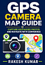
Discover how to use GPS camera technology to capture, organize, and navigate with confidence in GPS Camera Map and Location Guide: Capture Geotagged Photos and Navigate with Confidence by Rakesh Kumar. This practical guide explains how location-enabled cameras and smartphone apps connect photos with precise geographic data, helping you remember where every image was taken and make better use of your visual memories. Whether you are a traveler, photographer, hiker, property professional, field researcher, or everyday smartphone user, this book offers clear guidance for working with geotagged photos, digital maps, GPS coordinates, and location-based tools. Learn how to enable and manage location services, understand map markers and coordinates, review photo locations, plan routes, and navigate unfamiliar places more effectively. You will also discover useful ways to organize travel photography, document outdoor adventures, share location-aware images, and improve situational awareness while exploring. Written in an accessible, step-by-step style, this GPS camera guide is designed for readers with different levels of technical experience. It focuses on practical concepts and real-world applications rather than complicated jargon, making it easier to build confidence with camera maps, photo location data, and mobile navigation. From capturing meaningful travel memories to finding your way on the road, GPS Camera Map and Location Guide helps you turn your smartphone into a smarter visual and navigation companion.
Discover how to use GPS camera technology to capture, organize, and navigate with confidence in GPS Camera Map and Location Guide: Capture Geotagged Photos and Navigate with Confidence by Rakesh Kumar. This practical guide explains how location-enabled cameras and smartphone apps connect photos w...
Discover more
Ratings and reviews
10 reviews
About the author
Rakesh Kumar is an author focused on practical technology, mobile photography, GPS navigation, and location-based tools. His clear, accessible approach helps readers understand geotagged photos, digital maps, smartphone camera features, and everyday navigation with confidence. Through useful guidance and real-world applications, he makes complex technology easier for travelers, photographers, outdoor enthusiasts, and general smartphone users. GPS Camera Map and Location Guide reflects his commitment to creating approachable resources for modern digital living.
Rakesh Kumar is an author focused on practical technology, mobile photography, GPS navigation, and location-based tools. His clear, accessible approach helps readers understand geotagged photos, digital maps, smartphone camera features, and everyday navigation with confidence. Through useful guid...
Rate this ebook
Tell us what you think.
Reading information
Smartphones and tablets
Install the Google Play Books app for Android and iPad/iPhone. It syncs automatically with your account and allows you to read online or offline wherever you are.
Laptops and computers
You can listen to audiobooks purchased on Google Play using your computer's web browser.
eReaders and other devices
To read on e-ink devices like Kobo eReaders, you'll need to download a file and transfer it to your device. Follow the detailed Help Center instructions to transfer the files to supported eReaders.