About this ebook
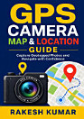
Discover how to turn your smartphone into a powerful GPS camera and navigation companion with GPS Camera Map Guide: Capture Geotagged Photos and Navigate with Confidence by Rakesh Kumar. This practical guide explains how location-enabled photography works and shows you how to capture, organize, and share photos with precise geographic information. Whether you are a traveler, hiker, field researcher, real estate professional, outdoor enthusiast, or everyday smartphone user, you will learn how GPS camera apps and map tools can make every image more meaningful and easier to find. Explore essential topics such as enabling location services, understanding GPS coordinates, reading map views, adding location stamps, checking photo metadata, managing privacy settings, and troubleshooting common geotagging problems. The guide also offers useful tips for planning trips, recording memorable journeys, documenting properties and projects, and navigating with greater confidence. Written in a clear, accessible style, this book is designed for beginners while remaining useful for readers who want to improve their mobile photography and location-based organization skills. Learn how to create a reliable visual record of where you have been, use digital maps more effectively, and make the most of GPS-enabled cameras. GPS Camera Map Guide is your practical companion for smarter geotagged photography, safer navigation, and better-organized memories.
Discover how to turn your smartphone into a powerful GPS camera and navigation companion with GPS Camera Map Guide: Capture Geotagged Photos and Navigate with Confidence by Rakesh Kumar. This practical guide explains how location-enabled photography works and shows you how to capture, organize, a...
Discover more
Ratings and reviews
3 reviews
About the author
Rakesh Kumar writes practical, accessible guides that help readers use everyday technology with greater confidence. His work focuses on smartphone photography, GPS camera tools, geotagged photos, digital maps, and location-based organization. Through clear explanations and useful real-world tips, he makes mobile navigation and photography easier for beginners and casual users. GPS Camera Map Guide reflects his commitment to helping readers capture, manage, and explore their experiences more effectively.
Rakesh Kumar writes practical, accessible guides that help readers use everyday technology with greater confidence. His work focuses on smartphone photography, GPS camera tools, geotagged photos, digital maps, and location-based organization. Through clear explanations and useful real-world tips,...
Rate this ebook
Tell us what you think.
Reading information
Smartphones and tablets
Install the Google Play Books app for Android and iPad/iPhone. It syncs automatically with your account and allows you to read online or offline wherever you are.
Laptops and computers
You can listen to audiobooks purchased on Google Play using your computer's web browser.
eReaders and other devices
To read on e-ink devices like Kobo eReaders, you'll need to download a file and transfer it to your device. Follow the detailed Help Center instructions to transfer the files to supported eReaders.