About this ebook
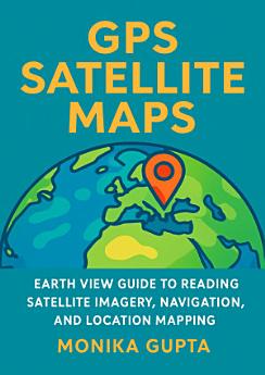
Unlock the world from above with GPS Satellite Maps—Earth View Guide to Reading Satellite Imagery, Navigation, and Location Mapping by Monika Gupta. Whether you’re a traveler planning routes, a student learning geospatial concepts, a hobbyist exploring Earth from your couch, or a professional seeking clearer map literacy, this practical guide helps you understand what you see in satellite images and how to use GPS data with confidence. Inside, you’ll learn how to interpret common features found in real satellite views—roads, coastlines, land cover, shadows, patterns, and elevation clues—so you can make smarter observations and more accurate location judgments. The book also breaks down the fundamentals of GPS and location mapping, explaining how coordinates, landmarks, and navigation workflows connect to real-world decisions. With step-by-step guidance, approachable explanations, and Earth-view examples, you’ll build essential skills for reading satellite imagery, understanding spatial relationships, and improving your map-based navigation. This is an ideal resource for anyone who wants to go beyond “where am I?” and truly understand “how do I interpret the landscape I’m looking at?” If you’re curious about maps, technology, and the geography of everyday life, GPS Satellite Maps will help you see the planet more clearly—one image, one coordinate, and one route at a time.
Unlock the world from above with GPS Satellite Maps—Earth View Guide to Reading Satellite Imagery, Navigation, and Location Mapping by Monika Gupta. Whether you’re a traveler planning routes, a student learning geospatial concepts, a hobbyist exploring Earth from your couch, or a professional see...
Discover more
About the author
Monika Gupta is a geography and mapping enthusiast with a focus on helping readers turn satellite imagery and GPS data into real-world understanding. Through clear, user-friendly explanations, she bridges the gap between everyday navigation and foundational geospatial concepts. Her approach emphasizes practical interpretation—so readers can look at a satellite view and confidently understand what it represents. Monika is passionate about making Earth science and location literacy accessible to students, travelers, and everyday explorers alike.
Monika Gupta is a geography and mapping enthusiast with a focus on helping readers turn satellite imagery and GPS data into real-world understanding. Through clear, user-friendly explanations, she bridges the gap between everyday navigation and foundational geospatial concepts. Her approach empha...
Rate this ebook
Tell us what you think.
Reading information
Smartphones and tablets
Install the Google Play Books app for Android and iPad/iPhone. It syncs automatically with your account and allows you to read online or offline wherever you are.
Laptops and computers
You can listen to audiobooks purchased on Google Play using your computer's web browser.
eReaders and other devices
To read on e-ink devices like Kobo eReaders, you'll need to download a file and transfer it to your device. Follow the detailed Help Center instructions to transfer the files to supported eReaders.