All About Topographic Maps
dets 2018 · Gareth Stevens Publishing LLLP
star
2 arvustust
E-raamat
24
lehekülge
Teave selle e-raamatu kohta
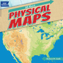
Which trail has a gentle slope? Where are the highest mountains along the Appalachian Trail? Is there a lake along the route? As students read this engaging volume, they will learn how to use United States Geological Survey (USGS) contour maps to answer these questions. They'll get an historical overview of how surveyors used to create these maps, and how technology now helps create more accurate maps. Students will construct 3D models of areas on a topographic map.
Which trail has a gentle slope? Where are the highest mountains along the Appalachian Trail? Is there a lake along the route? As students read this engaging volume, they will learn how to use United States Geological Survey (USGS) contour maps to answer these questions. They'll get an historical ...
Avastage rohkem
Hinnangud ja arvustused
2 arvustust
Hinnake seda e-raamatut
Andke meile teada, mida te arvate.
Lugemisteave
Nutitelefonid ja tahvelarvutid
Installige rakendus Google Play raamatud Androidile ja iPadile/iPhone'ile. See sünkroonitakse automaatselt teie kontoga ja see võimaldab teil asukohast olenemata lugeda nii võrgus kui ka võrguühenduseta.
Sülearvutid ja arvutid
Google Playst ostetud audioraamatuid saab kuulata arvuti veebibrauseris.
E-lugerid ja muud seadmed
E-tindi seadmetes (nt Kobo e-lugerid) lugemiseks peate faili alla laadima ja selle oma seadmesse üle kandma. Failide toetatud e-lugeritesse teisaldamiseks järgige üksikasjalikke abikeskuse juhiseid.