All About Topographic Maps
ডিচে ২০১৮ · Gareth Stevens Publishing LLLP
star
২ টা পৰ্যালোচনা
ইবুক
24
পৃষ্ঠা
এই ইবুকখনৰ বিষয়ে
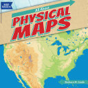
Which trail has a gentle slope? Where are the highest mountains along the Appalachian Trail? Is there a lake along the route? As students read this engaging volume, they will learn how to use United States Geological Survey (USGS) contour maps to answer these questions. They'll get an historical overview of how surveyors used to create these maps, and how technology now helps create more accurate maps. Students will construct 3D models of areas on a topographic map.
Which trail has a gentle slope? Where are the highest mountains along the Appalachian Trail? Is there a lake along the route? As students read this engaging volume, they will learn how to use United States Geological Survey (USGS) contour maps to answer these questions. They'll get an historical ...
অধিক বিচাৰি পাওক
মূল্যাংকন আৰু পৰ্যালোচনাসমূহ
২ টা পৰ্যালোচনা
এই ইবুকখনক মূল্যাংকন কৰক
আমাক আপোনাৰ মতামত জনাওক।
পঢ়াৰ নির্দেশাৱলী
স্মাৰ্টফ’ন আৰু টেবলেট
Android আৰু iPad/iPhoneৰ বাবে Google Play Books এপটো ইনষ্টল কৰক। ই স্বয়ংক্রিয়ভাৱে আপোনাৰ একাউণ্টৰ সৈতে ছিংক হয় আৰু আপুনি য'তে নাথাকক ত'তেই কোনো অডিঅ'বুক অনলাইন বা অফলাইনত শুনিবলৈ সুবিধা দিয়ে।
লেপটপ আৰু কম্পিউটাৰ
আপুনি কম্পিউটাৰৰ ৱেব ব্রাউজাৰ ব্যৱহাৰ কৰি Google Playত কিনা অডিঅ'বুকসমূহ শুনিব পাৰে।
ই-ৰীডাৰ আৰু অন্য ডিভাইচ
Kobo eReadersৰ দৰে ই-চিয়াঁহীৰ ডিভাইচসমূহত পঢ়িবলৈ, আপুনি এটা ফাইল ডাউনল’ড কৰি সেইটো আপোনাৰ ডিভাইচলৈ স্থানান্তৰণ কৰিব লাগিব। সমৰ্থিত ই-ৰিডাৰলৈ ফাইলটো কেনেকৈ স্থানান্তৰ কৰিব জানিবলৈ সহায় কেন্দ্ৰত থকা সবিশেষ নিৰ্দেশাৱলী চাওক।